
Where to go by boat from Porto Cesareo
Islands, coastal towers and white sandy beaches: the most beautiful spots to reach with a boat without a licence, with sailing times from the harbour and three ready-made itineraries.
The sea of the Marine Protected Area
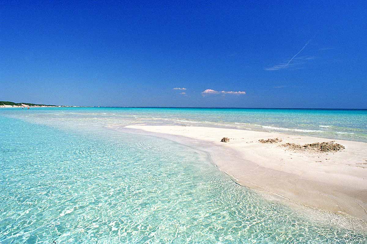
Porto Cesareo faces the Ionian Sea, on the western side of Salento. In front of the harbour lies the Marine Protected Area: about 17 km of low coastline with long beaches of very fine sand, low cliffs, islets and seabeds that stay transparent even several metres deep.
With a 40 hp boat that needs no licence you don’t have to pick just one beach: in a few minutes you go from the island in front of the harbour to the watchtowers and all the way to the dunes of Punta Prosciutto. Before you leave we give you the map with the protected-area zones and the best places to stop.
The 4 stops not to miss
Rabbit Island (Isola dei Conigli)
The largest island, right in front of the harbour: turquoise water and white sand. It’s the first stop for a swim as soon as you leave.
Torre Chianca and the Roman columns
A few metres down lie columns from Roman times: with mask and snorkel it’s a unique snorkelling spot in Salento.
Torre Lapillo
Shallow, sandy seabed in front of one of Salento’s most famous beaches. Stop offshore: perfect with children too.
Punta Prosciutto
High dunes and an emerald sea that recalls the Caribbean. The ideal destination for a full day, with lunch on board.
What to see by boat, stop by stop
From the harbour the route heads north, along the beaches and coastal towers, up to the edge of the protected area.
Core zone
The heart of the marine protected area. Admire it from the sea and respect the buoys and distances shown on the map.
The submerged Roman columns and, close by, Malva Island. Bring a mask: the seabed is worth it.
Light sand and shallow water: the right place for a long stop and a relaxed swim.
Heading north
A stretch of mixed sand and rock. Freshwater springs beneath the seabed make the sea especially clear.
The highest dunes on the coast and a gently sloping seabed: space, colours and postcard water.
The northern limit of the protected area, dominated by a defence tower: a wilder, less crowded coastline.
Three ready-made trips
Half day
- First swim at Rabbit Island
- Snorkelling over the Roman columns of Torre Chianca
- Stop off Torre Lapillo and return
All the way to Punta Prosciutto
- Route north along the coast
- Lunch on board in front of the dunes
- Return with stops in the coves of the reserve
Afternoon & sunset
- Swims at Rabbit Island in the hottest hours
- Aperitif at anchor (cool box with prosecco on request)
- The sun setting over the Ionian Sea, then back to the harbour
Not sure which to choose? Check the time slots and prices.
The rules of the protected area
The sea of Porto Cesareo is a protected natural area: a little care is all it takes to enjoy it and leave it intact.
Zone A: these are fully protected reserves where boats may not enter. They are marked on the map we give you at departure.
Red buoys: the area between the buoys and the shore is reserved for swimmers. Always stay outside it.
Speed: go slowly near the coast, beaches and wherever there are swimmers.
Anchor: only on sand and where allowed, never on posidonia seagrass or rocks.
Weather: with a strong tramontana or scirocco wind we suggest the most sheltered route.
Assistance: for any doubt call the King Boat staff, reachable even while you are at sea.
All rules and distances are explained in the briefing before you leave.
Questions about destinations
How long does it take to get to Rabbit Island?
About 5 minutes by boat from the harbour of Porto Cesareo: it’s the first stop for almost all our guests.
Can you reach Punta Prosciutto with a boat without a licence?
Yes, in about 30 minutes. To enjoy it at a relaxed pace we recommend the full day.
Where can you go snorkelling?
The most famous spot is the submerged Roman columns of Torre Chianca, about 10 minutes from the harbour. If you don’t have a mask, you can rent one from us for €5.
Can I stop and anchor wherever I want?
No: boats may not enter the zone A areas of the protected area, and the anchor may only be dropped on sand where allowed. At departure we give you the map with the zones and recommended spots.
What happens if it’s windy?
We assess the sea conditions together and suggest the most sheltered route. If the sea is not suitable, we let you know and agree on how to reschedule your trip.
Ready to plot your route?
Choose the day and time slot: we confirm your boat on WhatsApp within minutes.